|
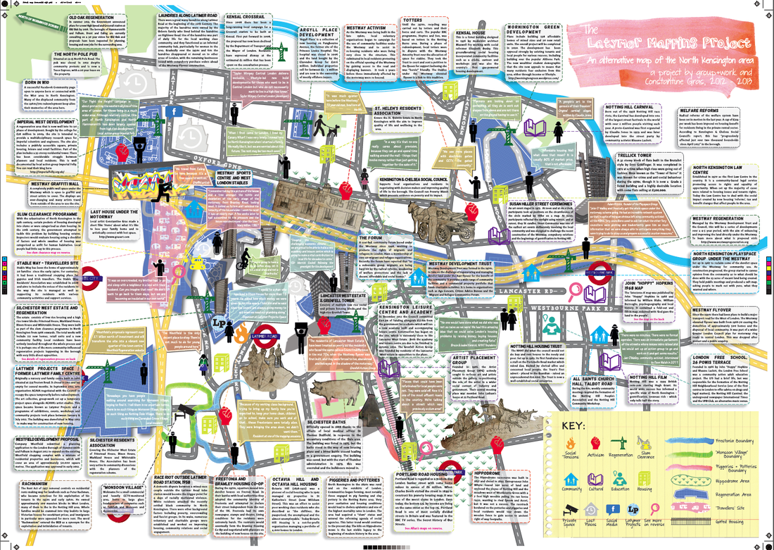
First tour: Saturday 20th July, 2pm. 2nd tour: Wednesday 24th July, 2pm. Starts from Latimer Road tube station and ends up at the Westway elevated flyover. Full details: Latymer Mapping Project, Facebook, InTRANSIT Festival Thankfully the cloud gathered over West London and spared us from the baking temperatures. Especially as we (Natalie Marr and Emily Ballard from group+work and myself) were about to plant some smart bombs during the guided walk. Armed with alternative maps, we explored the impact of the 1958 race riot, the slum clearance programme of the 20th century and the building of the Westway. We related these to contemporary housing issues and the regeneration schemes currently shaping the local area. How are communities affected by these processes of change and how can they shape the outcome? The walk was followed with a community launch of the map at the Dalgarno Centre. Steph Perkins who is a long-term resident of the Silchester Estate talked about her appointed role in the regeneration process. Maggie Tyler presented the case of how St. Helen's residents are campaigning against the Imperial West development taking place in the White City area. Check out the map. Tis a wondrous new addition to the cultural artefacts showcasing the rich and complex history of North Kensington. You can pick up your free copy from the following places: Dalgarno Centre, 1 Webb Close, London W10 5QB North Kensington Library, 108 Ladbroke Grove, London W11 1PZ The Tabernacle, 35 Powis Square, London W11 2AY Portobello Road Market Offices, 72 Tavistock Road, London W11 1AN
0 Comments
|
Categories
All
Archives
May 2024
|

 RSS Feed
