|
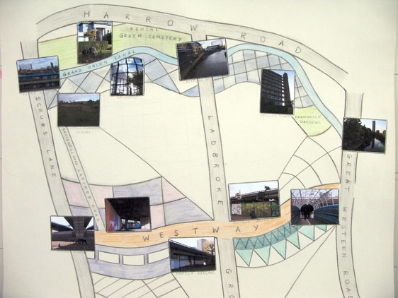
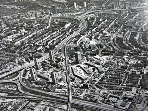
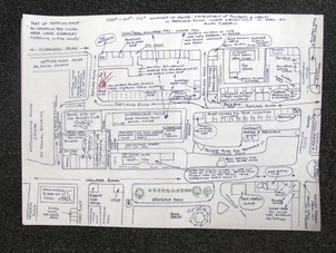
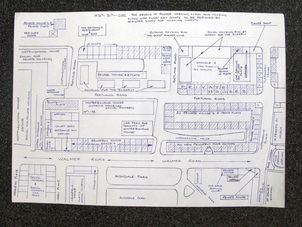
Took part in a HISTORYtalk event last night with Natalie Marr and Emily Ballard from Latymer Projects. I screened two short films called Flood Light (2010) and Home (2012). Also a selection of images culled from my archive research into the Grand Union Canal, Westway, Slum Clearance Programme and Silchester Estate development. This was a good opportunity for me to review my practice and to talk about maps created as part of my work. The first map, West London Waterways, was made in 2009 as part of a development bursary for the Cultural Olympiad. This got me noticed by the Arts Officer in RBKC and I was commissioned to stage an arts event as part of InTRANSIT 2010. Flood Light was a participatory film making project getting local residents and Londoners to connect with the inter-related legacy of the Grand Union Canal and Westway (A40). Naturally, I made a map and invited people to creatively journey across this landscape. Ten other film makers took up the challenge and produced excellent films. I was able to present this at the Portobello Film Festival alongside my own work. As a follow-up project, Home is about the last house demolished for the Westway. It's based on an evocative photograph taken by Mary Miller in the late 1960s. For several months I've been obsessively trying to find out more about this lost house and the home owner who refused to be moved as the wider area was demolished for slum clearance and Westway road building. No luck so far. I have microfiche disorder. At this juncture in time, I'm working with Latymer projects editing analogue and digital maps. We want to focus on the area around Bramley Road, Freston Road and the Silchester Estate in W10. This is an area steeped in radical history: 1958 race riot, Westway activism and Frestonia. It is also about to undergo regeneration (again) and our map will hopefully represent issues around community and housing. Check out the excellent map (below) made by Allan Tyrrell. For a full low down, visit the Latymer Mapping project website. 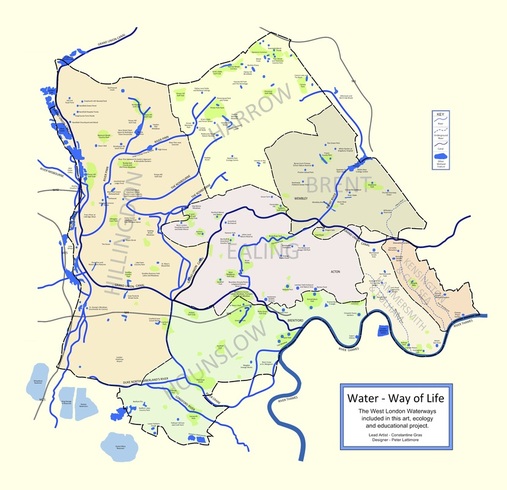 West London Waterways map, 2009. Inspiration for my eco-arts projects based around blue and green spaces in West London. 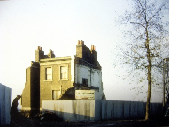 Last house demolished for the Westway, late 1960s. Photo by Mary Miller. © RBKC Local Studies and Archive. Comments are closed.
|
Categories
All
Archives
May 2024
|
 RSS Feed
